
In my thesis, “Examining Large-Scale Interactions Between Hazards, Exposure, and Vulnerability in Coastal Built Environments”, I delved into how coastal areas are affected by the compounded pressures of climate change, human development, and infrastructure. The idea was to explore the broader, often hidden patterns shaping these risks, beyond isolated case studies, to offer insights that can help coastal communities make better, more informed decisions when tackling the challenges of coastal risk.
A growing crisis: the cost of coastal development.
Coastal regions cover only a small fraction of the Earth’s surface, but their impact is massive. Over the centuries, humans have flocked to coasts, drawn by their natural beauty, rich resources, and proximity to trade routes. Today, over one in ten people live in low-lying coastal areas, and that number is growing faster than any other part of the world.
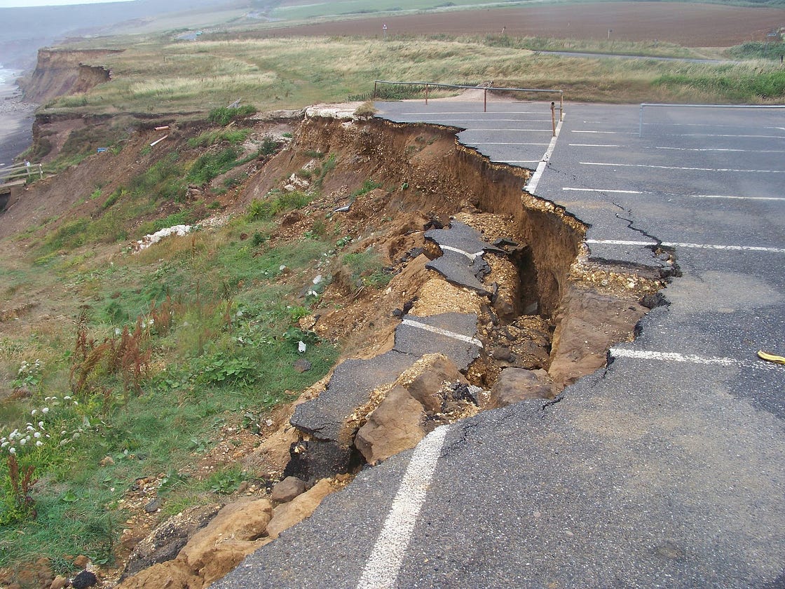
But as populations grow and cities expand, the risk to coastal areas intensifies. Rising sea levels, stronger storms, and more frequent flooding are taking their toll. Natural defenses like wetlands and dunes, which once protected these regions, are being replaced by roads, buildings, and concrete. In response, we’ve often turned to manmade solutions like seawalls and beach nourishment, hoping they will shield our communities. But these interventions sometimes create a false sense of security, luring even more development to risky areas. When a storm exceeds the capacity of these defenses, the damage can be devastating.
This isn’t just about climate change: it’s about understanding how climate risk is shaped by the complex, interconnected relationship between people, infrastructure, and the environment. Viewing coastal areas as dynamic, interconnected systems helps us see how human decisions and natural processes shape one another, often in ways that go unnoticed until it’s too late. Recognizing these relationships is key to developing long-term, sustainable strategies for coastal planning and risk management.
Moving beyond local case studies.
Despite the urgency of addressing coastal risk, most research still relies on isolated case studies. While these studies offer valuable insights into how specific areas respond to hazards, their findings are often too localized to apply universally. Every coastline has its own unique geography, infrastructure, and social dynamics, which makes it difficult to draw broad conclusions from just one or two locations.
In my research, I aimed to look at the bigger picture by uncovering patterns that could be applied to broader regions. But scaling up this kind of research presents its own set of challenges. Publicly available data at national or regional levels is often incomplete, inconsistent, or scattered across different platforms. Some of the most useful datasets are hidden behind paywalls, or simply don’t exist in a usable format.
But I made a conscious decision to rely exclusively on open-access data for my analysis. Why? Because open data promotes transparency, collaboration, and innovation. It makes it easier for a broader community — from scientists to planners to everyday citizens — to develop smarter tools and strategies for addressing coastal risk.
Open-access data: A game-changer for coastal risk assessment.
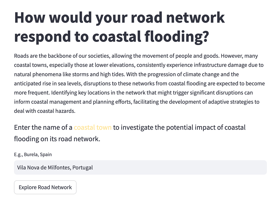
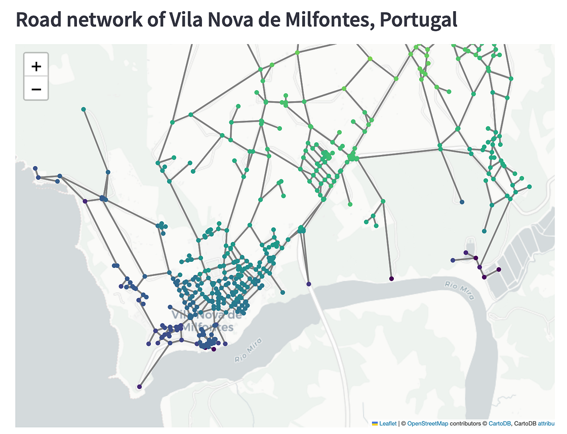
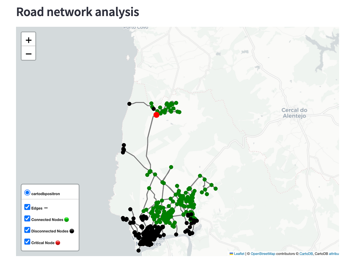
A prime example of my approach is a study I conducted on road networks across the U.S. Atlantic and Gulf barrier islands, published in Earth’s Future. Using only publicly available data and Python-based workflows (which I made available on GitHub), I assessed how susceptible these networks are to flooding. This work also led to the creation of an interactive tool — a simple yet powerful Streamlit app that brings my findings to life in a more accessible format.
The app works by simulating the removal of road network nodes based on their elevation, assuming that the lowest points will be the first to flood during storms or rising sea levels. Using OpenStreetMap data, the app allows users to explore the elevation of road nodes, visualize disruptions to the network, and identify areas most vulnerable to flooding. While the model simplifies reality by not factoring in protective infrastructure, it provides a useful starting point for understanding the potential failure of coastal road systems in flood-prone areas.
Designing smarter, more resilient coastal futures.
In the face of climate change, the stakes have never been higher for coastal communities. But by recognizing the complex, interconnected nature of coastal risk and embracing open data as a tool for smarter research, we can start to build a clearer, more accurate picture of the risks we face. With better insights, we can design more thoughtful, long-term strategies for coastal planning and risk management, ones that truly prepare us for the challenges ahead.
The key to effective coastal management lies not just in creating better defenses, but in understanding how all the pieces fit together. By viewing coasts as dynamic systems, where hazards, exposure, and vulnerability constantly interact, we can start to build communities that are more resilient — and better prepared for whatever the future holds.
Explore my thesis in greater detail here, or dive into the interactive tool on GitHub to see how road networks across barrier islands are being assessed for flood vulnerability.
Curious? Let’s work together to make coastal risk research more accessible, actionable, and collaborative for all.
.png)


